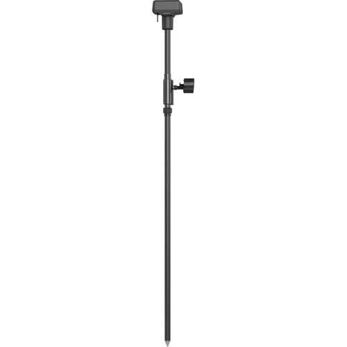
DJI D-RTK 2 High Precision GNSS Mobile Station
DJI D-RTK 2 High Precision GNSS Mobile Station: survey-grade RTK accuracy for enterprise drone operations
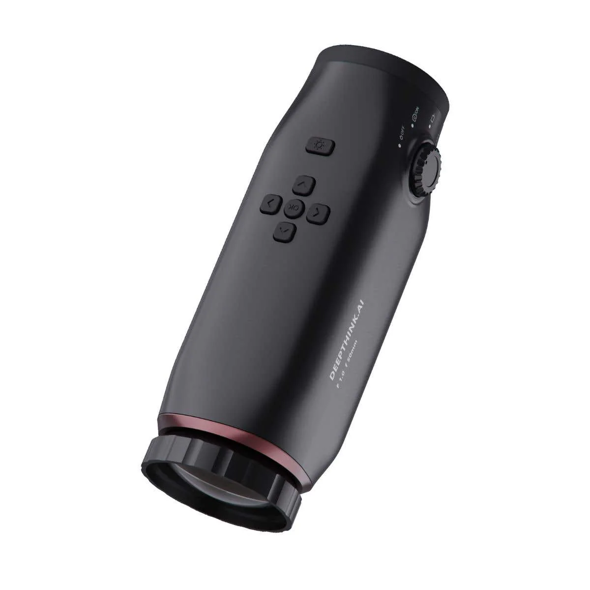
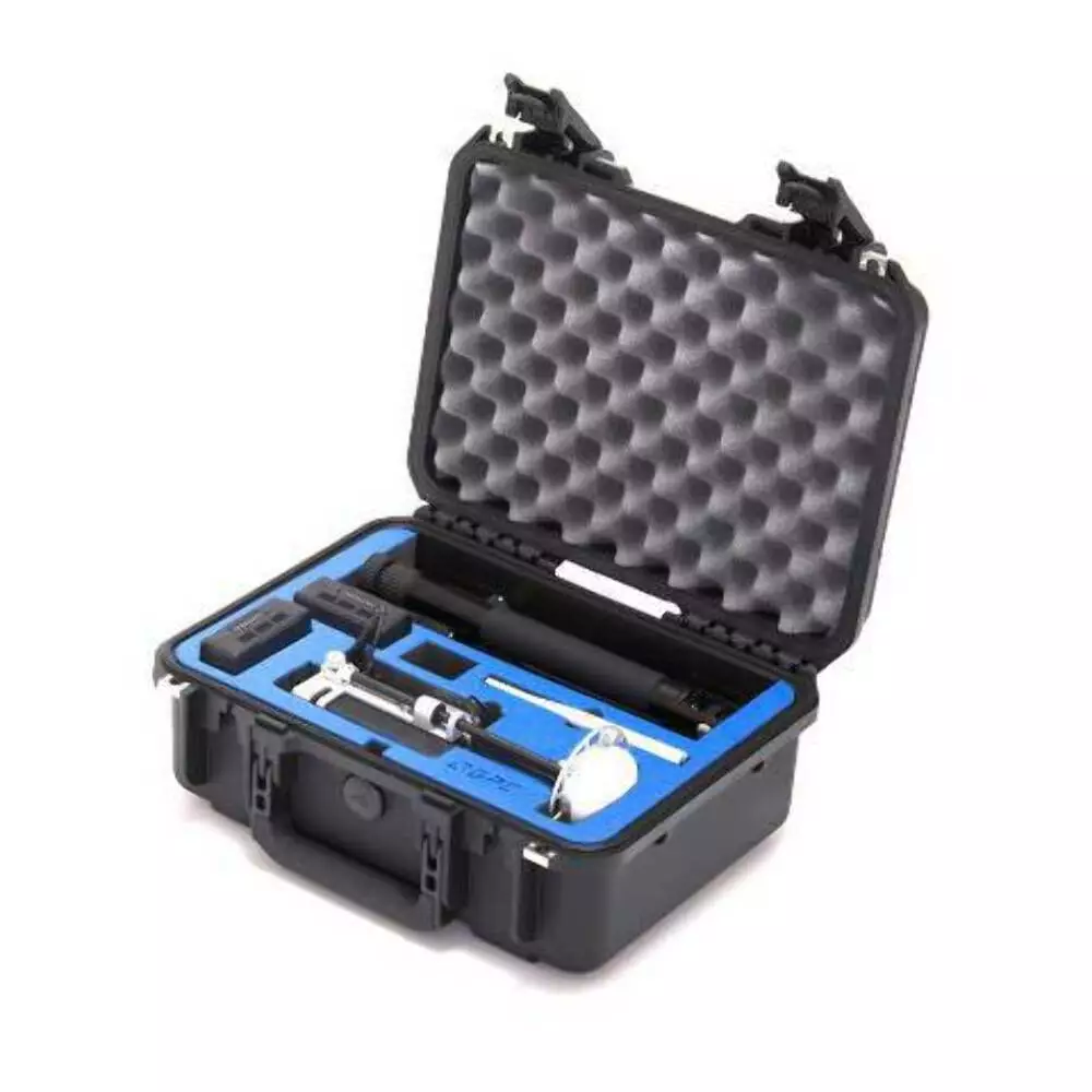
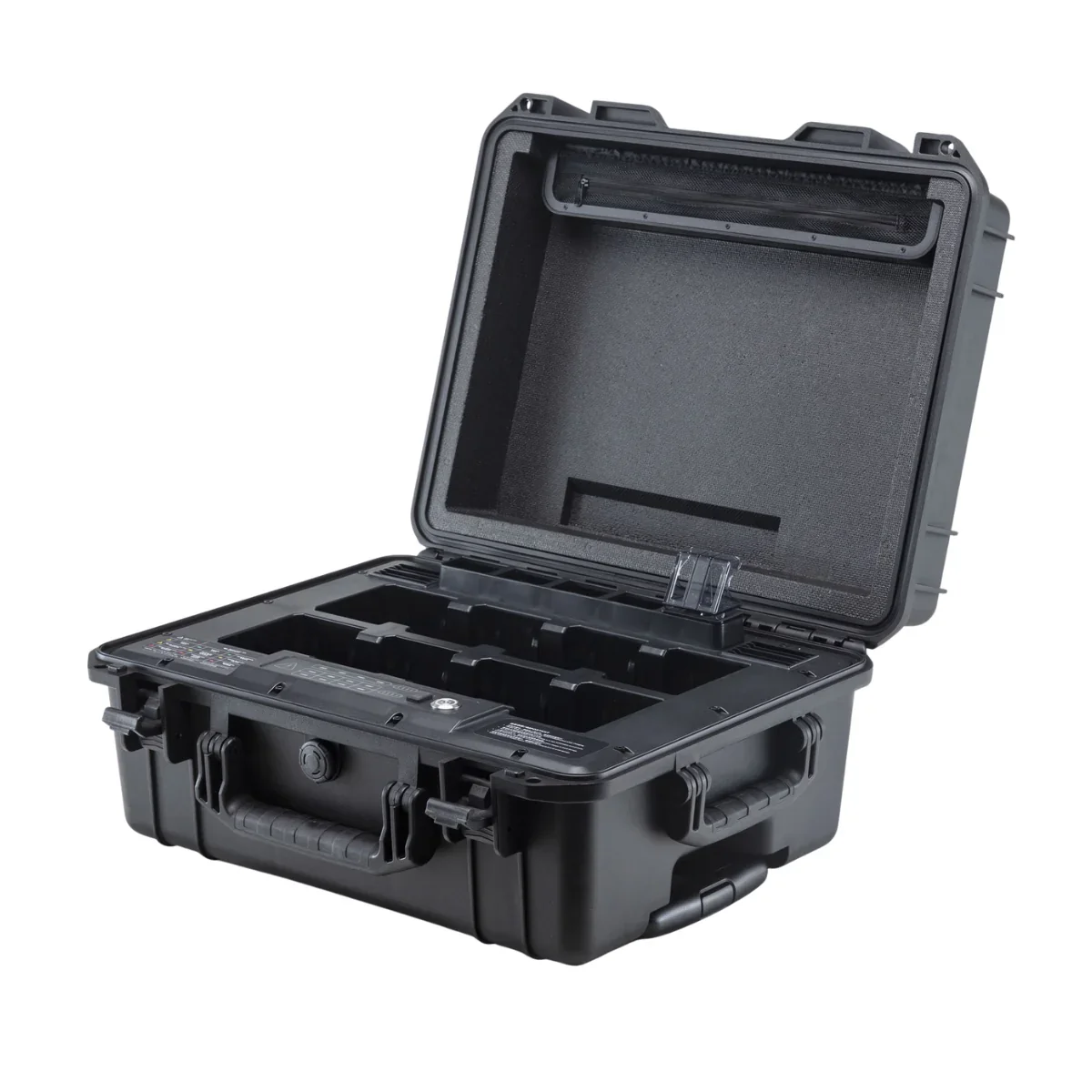
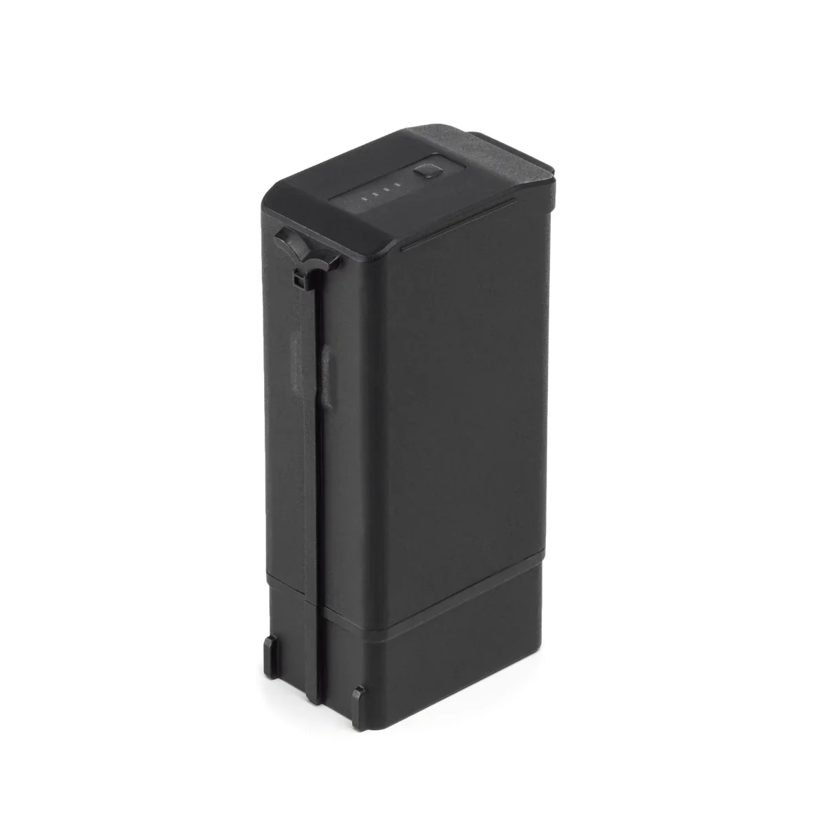
The DJI D-RTK 2 High Precision GNSS Mobile Station is a professional positioning solution designed to deliver centimeter-level accuracy for aerial mapping, surveying, and inspection workflows. Supplied as new DJI hardware, this mobile station provides real-time differential correction data to supported DJI enterprise aircraft and controllers. Built for demanding field environments, the D-RTK 2 supports reliable deployment across construction sites, infrastructure projects, and large-area geospatial operations.
Multi-frequency GNSS reception for consistent positioning accuracy
The D-RTK 2 simultaneously receives signals from GPS, BeiDou, GLONASS, and Galileo satellite systems across multiple frequency bands, improving positioning stability in complex environments. In RTK mode, the system supports horizontal positioning accuracy of 1 cm + 1 ppm and vertical accuracy of 2 cm + 1 ppm, enabling repeatable flight paths and reliable geospatial outputs. Initialization reliability exceeds 99.9 percent, with recapture times under 1 second for efficient field workflows.
Field-ready design with integrated IMU and flexible communications
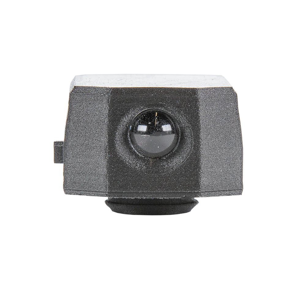
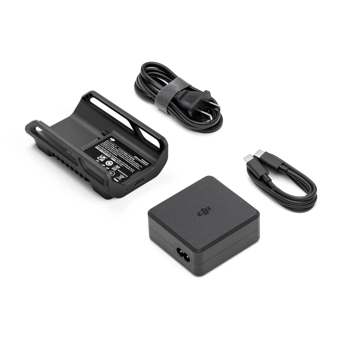
Designed for professional deployment, the D-RTK 2 features an IP65-rated enclosure and supports sloping measurements using a built-in high-precision 6-axis IMU. Communication options include OcuSync, Wi-Fi, LAN, and 4G, enabling flexible deployment as a mobile base or fixed reference station. Integrated storage supports local data logging, while multiple operating modes allow long-distance communication between aircraft, controllers, and the base station.
Core features at a glance
- Multi-frequency GNSS supports GPS, BeiDou, GLONASS, and Galileo systems.
- RTK positioning accuracy supports 1 cm + 1 ppm horizontal precision.
- Vertical RTK accuracy supports 2 cm + 1 ppm positioning performance.
- Position update rates support up to 20 Hz.
- Initialization reliability exceeds 99.9 percent for field operations.
- Built-in 6-axis IMU supports sloping measurements and movement monitoring.
- IP65-rated enclosure supports harsh outdoor environments.
- Multiple communication links support flexible deployment scenarios.
Platform compatibility and workflow connectivity
- Compatible with supported DJI enterprise aircraft and controllers.
- Supports RTCM 2.X and 3.X differential data formats.
- Operates as a mobile base station or fixed reference station.
- Supports OcuSync, Wi-Fi, LAN, and 4G data transmission.
- Integrates into professional mapping and surveying workflows.
Compatible Drones (with proper firmware/mode):
- Matrice 400 RTK / 350 RTK / 300 RTK: Fully supported for complex missions.
- Mavic 3 Enterprise Series (M3E/M3T): Works as a base or rover station.
- Matrice 30 Series (M30/M30T): Compatible for high-precision data.
- Phantom 4 RTK & P4 Multispectral: Classic RTK solutions.
- Agras T16/T20/T30 & MG-1P RTK: Used for precision agriculture.
- Inspire 3: Works in broadcast mode for precise positioning.
- DJI FlyCart 30 (FC30): Supports enterprise heavy-lift operations.
- Matrice 210 RTK V2: Supports Operation Mode 4.
Professional applications and use cases
- Aerial mapping: achieve centimeter-level positioning for high-accuracy photogrammetry missions.
- Land surveying: collect survey-grade geospatial data with repeatable RTK corrections.
- Construction monitoring: document site progress with consistent positional reference points.
- Infrastructure inspection: map assets accurately for maintenance and lifecycle planning.
- Mining surveys: capture reliable elevation and volume data across active quarry sites.
- Utility corridor mapping: maintain alignment accuracy along linear infrastructure routes.
- Environmental analysis: support land-use studies requiring consistent geospatial accuracy.
- Engineering surveys: improve confidence in measurements for design and planning workflows.
Built for enterprise field reliability
The DJI D-RTK 2 is engineered for professionals who require dependable positioning accuracy in dynamic field environments. Its multi-GNSS support, high-rate positioning updates, and rugged design enable consistent performance across varied terrain and jobsite conditions. When integrated into an enterprise drone workflow, the system improves data confidence and operational efficiency.
The DJI D-RTK 2 High Precision GNSS Mobile Station delivers reliable RTK positioning for professional aerial operations. DSLRPros provides expert configuration guidance and post-sale support to help teams deploy with confidence.
Available now from DSLRPros. Purchase today to enhance the accuracy of your enterprise drone missions.
DJI D-RTK 2 High Precision GNSS Mobile Station: survey-grade RTK accuracy for enterprise drone operations
The DJI D-RTK 2 High Precision GNSS Mobile Station is a professional positioning solution designed to deliver centimeter-level accuracy for aerial mapping, surveying, and inspection workflows. Supplied as new DJI hardware, this mobile station provides real-time differential correction data to supported DJI enterprise aircraft and controllers. Built for demanding field environments, the D-RTK 2 supports reliable deployment across construction sites, infrastructure projects, and large-area geospatial operations.
Multi-frequency GNSS reception for consistent positioning accuracy
The D-RTK 2 simultaneously receives signals from GPS, BeiDou, GLONASS, and Galileo satellite systems across multiple frequency bands, improving positioning stability in complex environments. In RTK mode, the system supports horizontal positioning accuracy of 1 cm + 1 ppm and vertical accuracy of 2 cm + 1 ppm, enabling repeatable flight paths and reliable geospatial outputs. Initialization reliability exceeds 99.9 percent, with recapture times under 1 second for efficient field workflows.
Field-ready design with integrated IMU and flexible communications
Designed for professional deployment, the D-RTK 2 features an IP65-rated enclosure and supports sloping measurements using a built-in high-precision 6-axis IMU. Communication options include OcuSync, Wi-Fi, LAN, and 4G, enabling flexible deployment as a mobile base or fixed reference station. Integrated storage supports local data logging, while multiple operating modes allow long-distance communication between aircraft, controllers, and the base station.
Core features at a glance
- Multi-frequency GNSS supports GPS, BeiDou, GLONASS, and Galileo systems.
- RTK positioning accuracy supports 1 cm + 1 ppm horizontal precision.
- Vertical RTK accuracy supports 2 cm + 1 ppm positioning performance.
- Position update rates support up to 20 Hz.
- Initialization reliability exceeds 99.9 percent for field operations.
- Built-in 6-axis IMU supports sloping measurements and movement monitoring.
- IP65-rated enclosure supports harsh outdoor environments.
- Multiple communication links support flexible deployment scenarios.
Platform compatibility and workflow connectivity
- Compatible with supported DJI enterprise aircraft and controllers.
- Supports RTCM 2.X and 3.X differential data formats.
- Operates as a mobile base station or fixed reference station.
- Supports OcuSync, Wi-Fi, LAN, and 4G data transmission.
- Integrates into professional mapping and surveying workflows.
Compatible Drones (with proper firmware/mode):
- Matrice 400 RTK / 350 RTK / 300 RTK: Fully supported for complex missions.
- Mavic 3 Enterprise Series (M3E/M3T): Works as a base or rover station.
- Matrice 30 Series (M30/M30T): Compatible for high-precision data.
- Phantom 4 RTK & P4 Multispectral: Classic RTK solutions.
- Agras T16/T20/T30 & MG-1P RTK: Used for precision agriculture.
- Inspire 3: Works in broadcast mode for precise positioning.
- DJI FlyCart 30 (FC30): Supports enterprise heavy-lift operations.
- Matrice 210 RTK V2: Supports Operation Mode 4.
Professional applications and use cases
- Aerial mapping: achieve centimeter-level positioning for high-accuracy photogrammetry missions.
- Land surveying: collect survey-grade geospatial data with repeatable RTK corrections.
- Construction monitoring: document site progress with consistent positional reference points.
- Infrastructure inspection: map assets accurately for maintenance and lifecycle planning.
- Mining surveys: capture reliable elevation and volume data across active quarry sites.
- Utility corridor mapping: maintain alignment accuracy along linear infrastructure routes.
- Environmental analysis: support land-use studies requiring consistent geospatial accuracy.
- Engineering surveys: improve confidence in measurements for design and planning workflows.
Built for enterprise field reliability
The DJI D-RTK 2 is engineered for professionals who require dependable positioning accuracy in dynamic field environments. Its multi-GNSS support, high-rate positioning updates, and rugged design enable consistent performance across varied terrain and jobsite conditions. When integrated into an enterprise drone workflow, the system improves data confidence and operational efficiency.
The DJI D-RTK 2 High Precision GNSS Mobile Station delivers reliable RTK positioning for professional aerial operations. DSLRPros provides expert configuration guidance and post-sale support to help teams deploy with confidence.
Available now from DSLRPros. Purchase today to enhance the accuracy of your enterprise drone missions.
Original: $2,899.00
-70%$2,899.00
$869.70Description
DJI D-RTK 2 High Precision GNSS Mobile Station: survey-grade RTK accuracy for enterprise drone operations
The DJI D-RTK 2 High Precision GNSS Mobile Station is a professional positioning solution designed to deliver centimeter-level accuracy for aerial mapping, surveying, and inspection workflows. Supplied as new DJI hardware, this mobile station provides real-time differential correction data to supported DJI enterprise aircraft and controllers. Built for demanding field environments, the D-RTK 2 supports reliable deployment across construction sites, infrastructure projects, and large-area geospatial operations.
Multi-frequency GNSS reception for consistent positioning accuracy
The D-RTK 2 simultaneously receives signals from GPS, BeiDou, GLONASS, and Galileo satellite systems across multiple frequency bands, improving positioning stability in complex environments. In RTK mode, the system supports horizontal positioning accuracy of 1 cm + 1 ppm and vertical accuracy of 2 cm + 1 ppm, enabling repeatable flight paths and reliable geospatial outputs. Initialization reliability exceeds 99.9 percent, with recapture times under 1 second for efficient field workflows.
Field-ready design with integrated IMU and flexible communications
Designed for professional deployment, the D-RTK 2 features an IP65-rated enclosure and supports sloping measurements using a built-in high-precision 6-axis IMU. Communication options include OcuSync, Wi-Fi, LAN, and 4G, enabling flexible deployment as a mobile base or fixed reference station. Integrated storage supports local data logging, while multiple operating modes allow long-distance communication between aircraft, controllers, and the base station.
Core features at a glance
- Multi-frequency GNSS supports GPS, BeiDou, GLONASS, and Galileo systems.
- RTK positioning accuracy supports 1 cm + 1 ppm horizontal precision.
- Vertical RTK accuracy supports 2 cm + 1 ppm positioning performance.
- Position update rates support up to 20 Hz.
- Initialization reliability exceeds 99.9 percent for field operations.
- Built-in 6-axis IMU supports sloping measurements and movement monitoring.
- IP65-rated enclosure supports harsh outdoor environments.
- Multiple communication links support flexible deployment scenarios.
Platform compatibility and workflow connectivity
- Compatible with supported DJI enterprise aircraft and controllers.
- Supports RTCM 2.X and 3.X differential data formats.
- Operates as a mobile base station or fixed reference station.
- Supports OcuSync, Wi-Fi, LAN, and 4G data transmission.
- Integrates into professional mapping and surveying workflows.
Compatible Drones (with proper firmware/mode):
- Matrice 400 RTK / 350 RTK / 300 RTK: Fully supported for complex missions.
- Mavic 3 Enterprise Series (M3E/M3T): Works as a base or rover station.
- Matrice 30 Series (M30/M30T): Compatible for high-precision data.
- Phantom 4 RTK & P4 Multispectral: Classic RTK solutions.
- Agras T16/T20/T30 & MG-1P RTK: Used for precision agriculture.
- Inspire 3: Works in broadcast mode for precise positioning.
- DJI FlyCart 30 (FC30): Supports enterprise heavy-lift operations.
- Matrice 210 RTK V2: Supports Operation Mode 4.
Professional applications and use cases
- Aerial mapping: achieve centimeter-level positioning for high-accuracy photogrammetry missions.
- Land surveying: collect survey-grade geospatial data with repeatable RTK corrections.
- Construction monitoring: document site progress with consistent positional reference points.
- Infrastructure inspection: map assets accurately for maintenance and lifecycle planning.
- Mining surveys: capture reliable elevation and volume data across active quarry sites.
- Utility corridor mapping: maintain alignment accuracy along linear infrastructure routes.
- Environmental analysis: support land-use studies requiring consistent geospatial accuracy.
- Engineering surveys: improve confidence in measurements for design and planning workflows.
Built for enterprise field reliability
The DJI D-RTK 2 is engineered for professionals who require dependable positioning accuracy in dynamic field environments. Its multi-GNSS support, high-rate positioning updates, and rugged design enable consistent performance across varied terrain and jobsite conditions. When integrated into an enterprise drone workflow, the system improves data confidence and operational efficiency.
The DJI D-RTK 2 High Precision GNSS Mobile Station delivers reliable RTK positioning for professional aerial operations. DSLRPros provides expert configuration guidance and post-sale support to help teams deploy with confidence.
Available now from DSLRPros. Purchase today to enhance the accuracy of your enterprise drone missions.