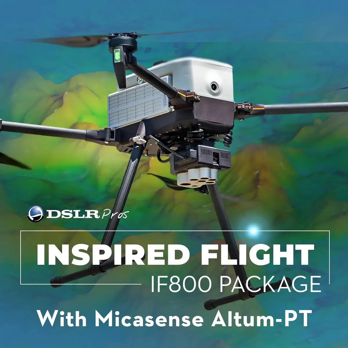
DSLRPros Inspired Flight IF800 MicaSense Altum PT Combo
Advanced Aerial Imaging and Precision Agriculture with IF800 + MicaSense Altum-PT
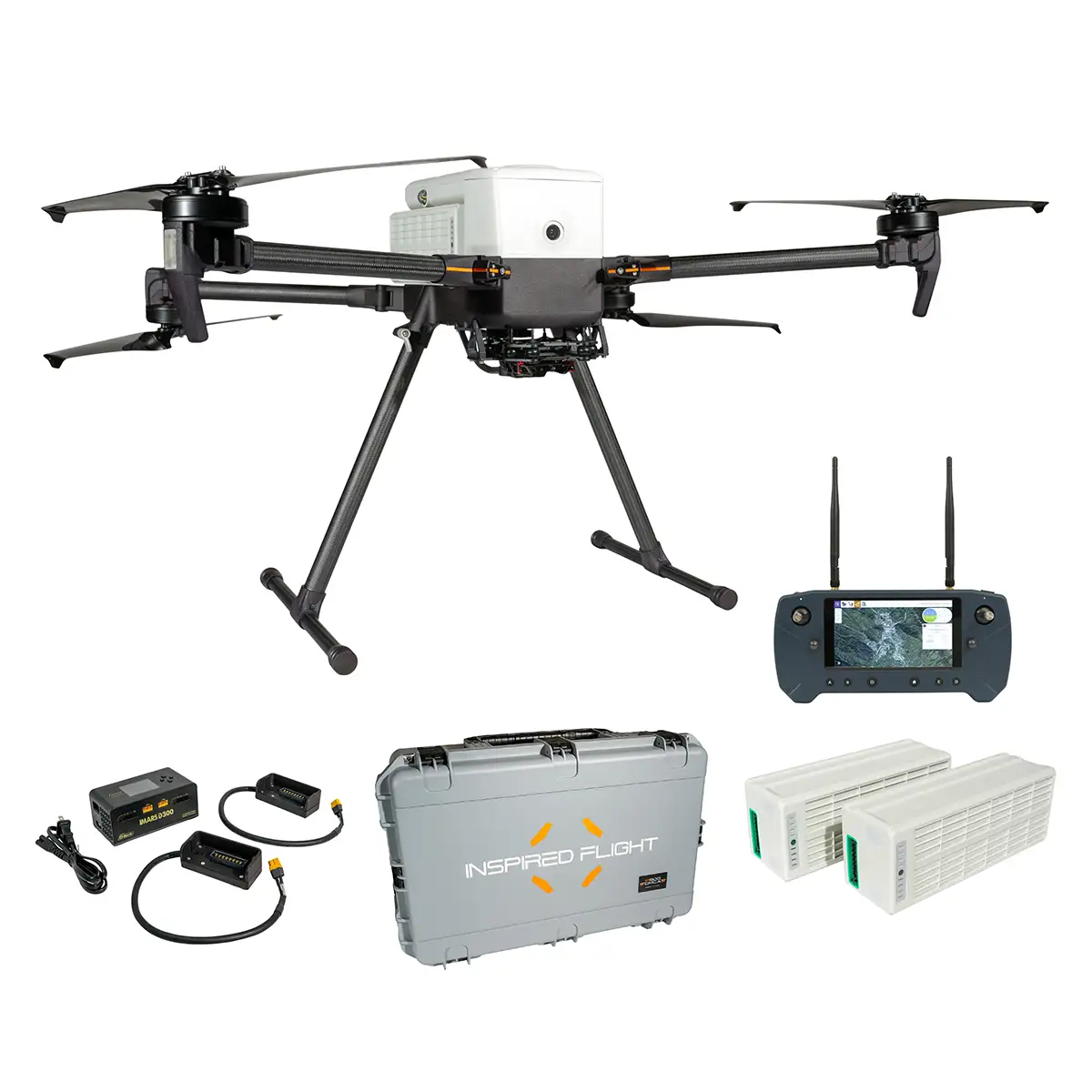
The IF800-MicaSense Altum-PT Combo is the ultimate package for advanced aerial imaging and precision agriculture.
This comprehensive combo includes the IF800 Quadcopter equipped with the advanced Blue Herelink Ground Control Station, the Inspired Flight MicaSense Altum-PT Integration, and the high-performance MicaSense Altum PT sensor.
IF800 Core Features
The IF800 is built to endure long missions while carrying professional-grade payloads:
- NDAA-compliant and Blue UAS-approved: Highly trusted platform for government, defense, and critical-infrastructure operations
- Long flight time: Up to 54 minutes of endurance.
- High payload capacity: 6.6 lbs (3.0 kg) for EO/IR, optical, and LiDAR sensors.
- Fast & stable: Max speed of 49 mph with wind resistance up to 23 knots.
- All-weather reliability: IP55-rated design protects against dust and water spray.
- Uninterrupted operations: Hot-swappable batteries allow up to 5 hours of runtime.
- Extended reach: Maintain control and data transmission up to 6 miles.
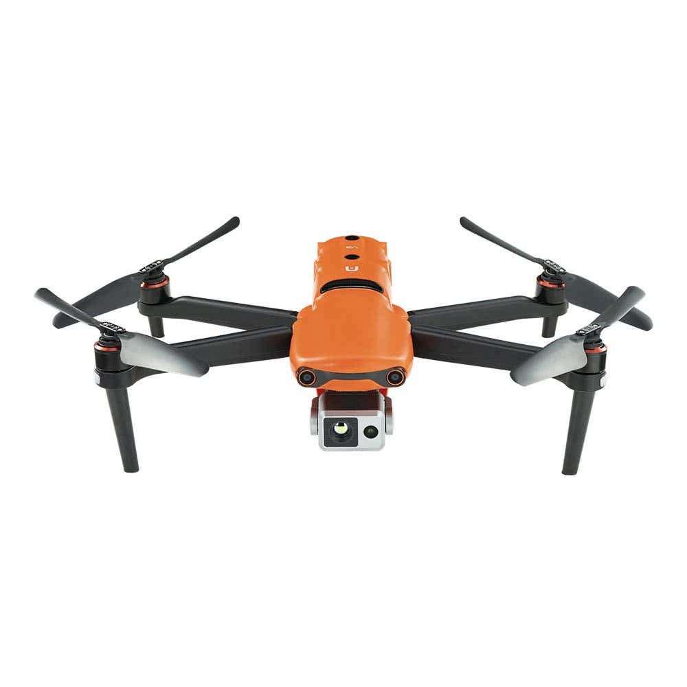
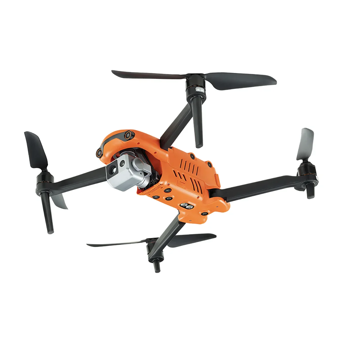
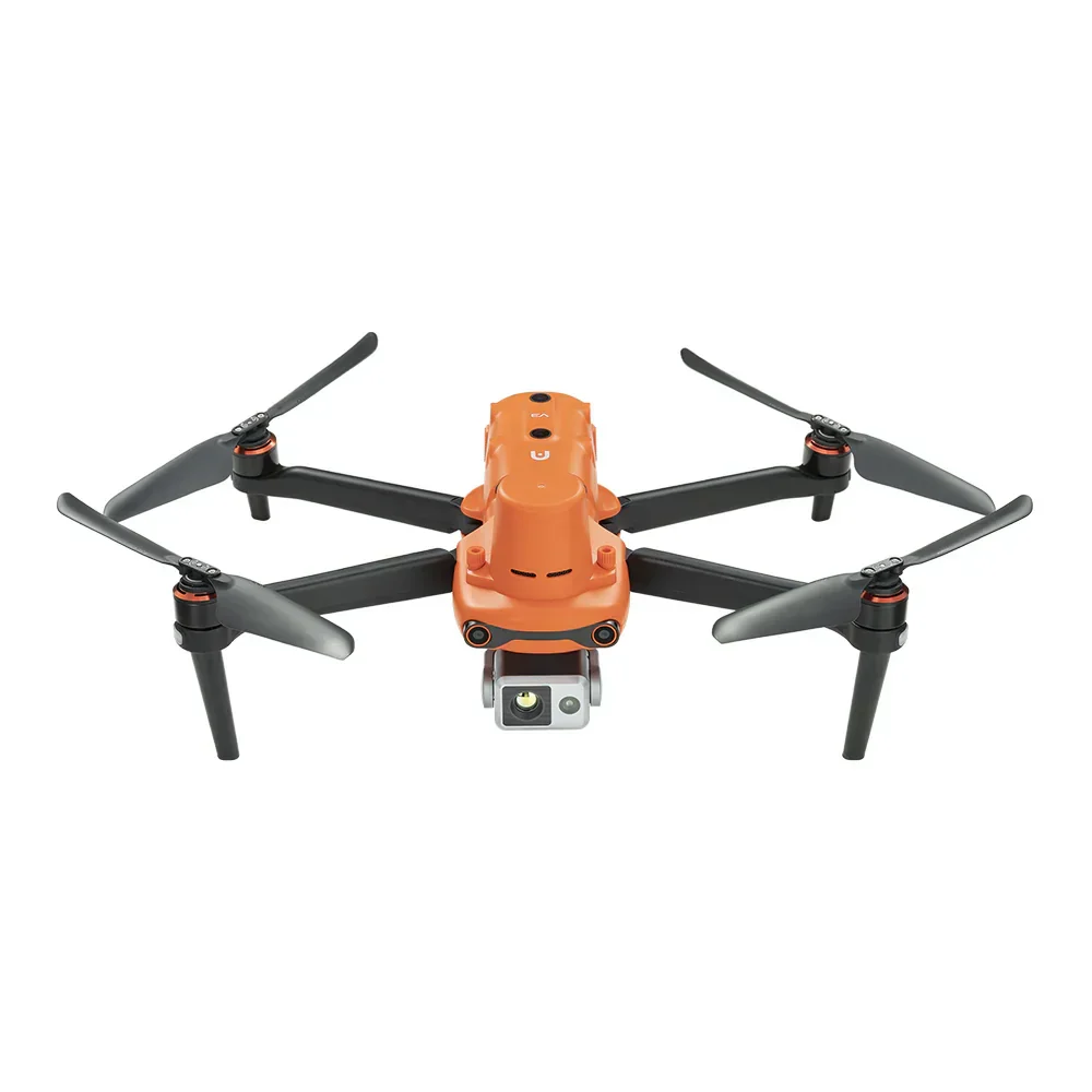
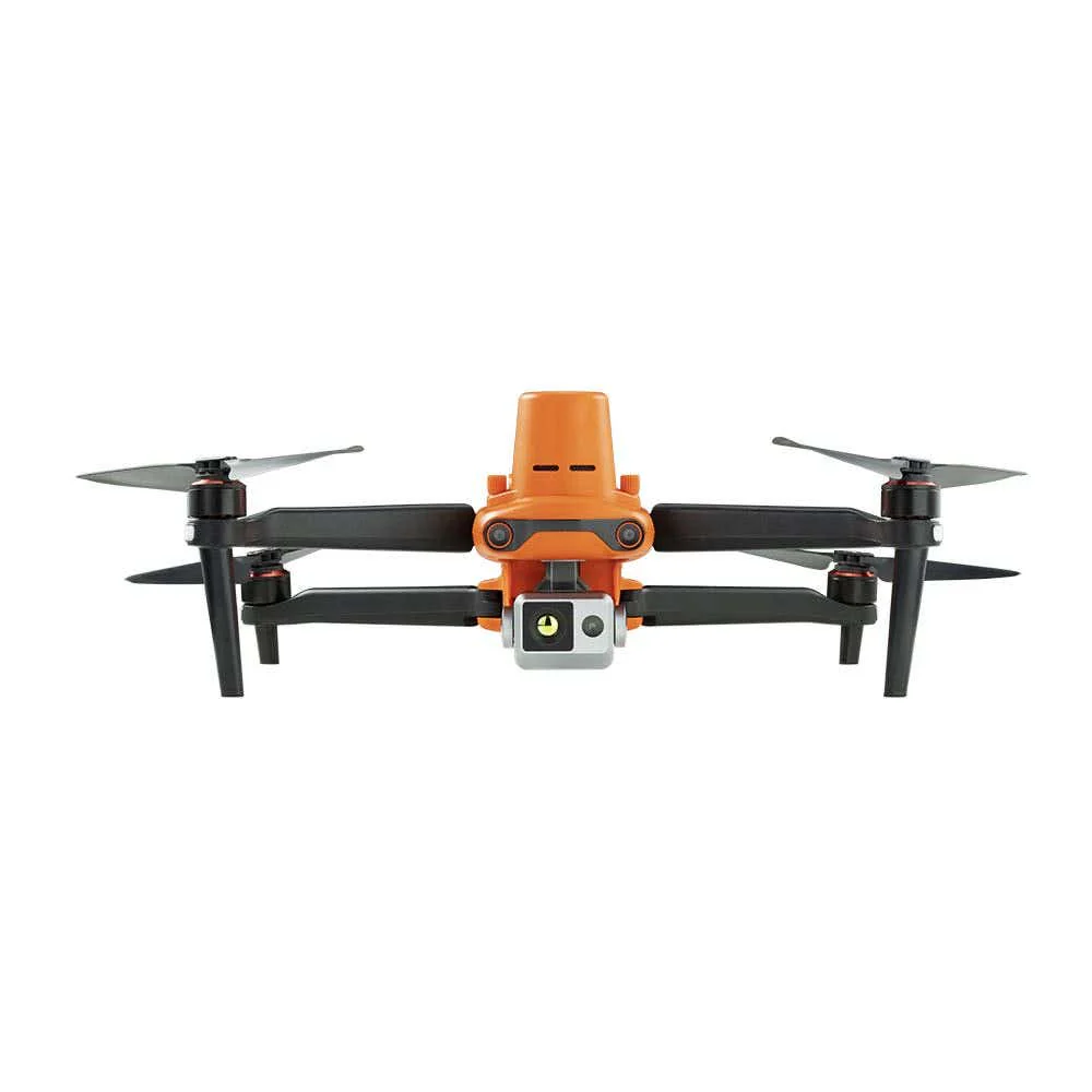
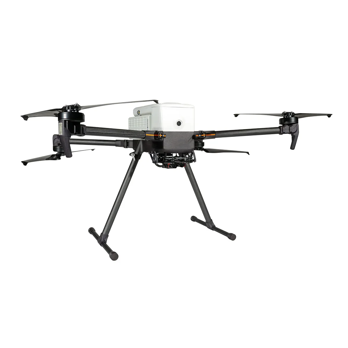
The IF800 Quadcopter is known for its lightweight, foldable frame, dual hot-swappable smart batteries, and up to 54 minutes of flight time, making it ideal for extended agricultural missions.
The MicaSense Altum-PT Advantage
Built for professionals who demand accuracy and efficiency, the Altum-PT combines thermal, multispectral, and panchromatic sensors in one streamlined payload.
From scientific trials to commercial agriculture, these features enable powerful insights in fewer flights.
- Triple-sensor power in one payload: Capture multispectral, thermal, and panchromatic data in a single pass, with 12 MP pan-sharpened detail.
- Global shutter and synchronized capture: All bands use a global shutter for pixel-aligned, distortion-free imagery during fast or low-altitude flights.
- Radiometric thermal imaging: A FLIR thermal sensor provides calibrated temperature data for crop stress and irrigation insights.
- Flexible integration: Works with many DJI drones and planning software like Pix4D and Agisoft, with full RAW data access.
- Integrated RTK support: Supports external RTK systems for centimeter-level geotagging without ground control points
The MicaSense Altum PT sensor captures high-resolution multispectral and thermal imagery, providing detailed data for agricultural and environmental applications.
The Altum-PT Integration ensures seamless mounting and optimal performance, making it perfect for precise data collection and analysis.
Other Benefits and Optional Add-Ons
This package also includes a Firmware Upgrade Service to keep your system up-to-date with the latest features and improvements.
Optional items include the IF800 Battery Kit, IF800 Battery Set, IF800 Spare Propeller Set, IF800 Spare Part Kit, and the PIX4Dfields - Perpetual License for advanced mapping software.
The IF800 MicaSense Altum-PT Combo is a comprehensive solution that enhances your drone operations with precision, advanced technology, and continuous support.
Advanced Aerial Imaging and Precision Agriculture with IF800 + MicaSense Altum-PT
The IF800-MicaSense Altum-PT Combo is the ultimate package for advanced aerial imaging and precision agriculture.
This comprehensive combo includes the IF800 Quadcopter equipped with the advanced Blue Herelink Ground Control Station, the Inspired Flight MicaSense Altum-PT Integration, and the high-performance MicaSense Altum PT sensor.
IF800 Core Features
The IF800 is built to endure long missions while carrying professional-grade payloads:
- NDAA-compliant and Blue UAS-approved: Highly trusted platform for government, defense, and critical-infrastructure operations
- Long flight time: Up to 54 minutes of endurance.
- High payload capacity: 6.6 lbs (3.0 kg) for EO/IR, optical, and LiDAR sensors.
- Fast & stable: Max speed of 49 mph with wind resistance up to 23 knots.
- All-weather reliability: IP55-rated design protects against dust and water spray.
- Uninterrupted operations: Hot-swappable batteries allow up to 5 hours of runtime.
- Extended reach: Maintain control and data transmission up to 6 miles.
The IF800 Quadcopter is known for its lightweight, foldable frame, dual hot-swappable smart batteries, and up to 54 minutes of flight time, making it ideal for extended agricultural missions.
The MicaSense Altum-PT Advantage
Built for professionals who demand accuracy and efficiency, the Altum-PT combines thermal, multispectral, and panchromatic sensors in one streamlined payload.
From scientific trials to commercial agriculture, these features enable powerful insights in fewer flights.
- Triple-sensor power in one payload: Capture multispectral, thermal, and panchromatic data in a single pass, with 12 MP pan-sharpened detail.
- Global shutter and synchronized capture: All bands use a global shutter for pixel-aligned, distortion-free imagery during fast or low-altitude flights.
- Radiometric thermal imaging: A FLIR thermal sensor provides calibrated temperature data for crop stress and irrigation insights.
- Flexible integration: Works with many DJI drones and planning software like Pix4D and Agisoft, with full RAW data access.
- Integrated RTK support: Supports external RTK systems for centimeter-level geotagging without ground control points
The MicaSense Altum PT sensor captures high-resolution multispectral and thermal imagery, providing detailed data for agricultural and environmental applications.
The Altum-PT Integration ensures seamless mounting and optimal performance, making it perfect for precise data collection and analysis.
Other Benefits and Optional Add-Ons
This package also includes a Firmware Upgrade Service to keep your system up-to-date with the latest features and improvements.
Optional items include the IF800 Battery Kit, IF800 Battery Set, IF800 Spare Propeller Set, IF800 Spare Part Kit, and the PIX4Dfields - Perpetual License for advanced mapping software.
The IF800 MicaSense Altum-PT Combo is a comprehensive solution that enhances your drone operations with precision, advanced technology, and continuous support.
Original: $37,745.00
-70%$37,745.00
$11,323.50Description
Advanced Aerial Imaging and Precision Agriculture with IF800 + MicaSense Altum-PT
The IF800-MicaSense Altum-PT Combo is the ultimate package for advanced aerial imaging and precision agriculture.
This comprehensive combo includes the IF800 Quadcopter equipped with the advanced Blue Herelink Ground Control Station, the Inspired Flight MicaSense Altum-PT Integration, and the high-performance MicaSense Altum PT sensor.
IF800 Core Features
The IF800 is built to endure long missions while carrying professional-grade payloads:
- NDAA-compliant and Blue UAS-approved: Highly trusted platform for government, defense, and critical-infrastructure operations
- Long flight time: Up to 54 minutes of endurance.
- High payload capacity: 6.6 lbs (3.0 kg) for EO/IR, optical, and LiDAR sensors.
- Fast & stable: Max speed of 49 mph with wind resistance up to 23 knots.
- All-weather reliability: IP55-rated design protects against dust and water spray.
- Uninterrupted operations: Hot-swappable batteries allow up to 5 hours of runtime.
- Extended reach: Maintain control and data transmission up to 6 miles.
The IF800 Quadcopter is known for its lightweight, foldable frame, dual hot-swappable smart batteries, and up to 54 minutes of flight time, making it ideal for extended agricultural missions.
The MicaSense Altum-PT Advantage
Built for professionals who demand accuracy and efficiency, the Altum-PT combines thermal, multispectral, and panchromatic sensors in one streamlined payload.
From scientific trials to commercial agriculture, these features enable powerful insights in fewer flights.
- Triple-sensor power in one payload: Capture multispectral, thermal, and panchromatic data in a single pass, with 12 MP pan-sharpened detail.
- Global shutter and synchronized capture: All bands use a global shutter for pixel-aligned, distortion-free imagery during fast or low-altitude flights.
- Radiometric thermal imaging: A FLIR thermal sensor provides calibrated temperature data for crop stress and irrigation insights.
- Flexible integration: Works with many DJI drones and planning software like Pix4D and Agisoft, with full RAW data access.
- Integrated RTK support: Supports external RTK systems for centimeter-level geotagging without ground control points
The MicaSense Altum PT sensor captures high-resolution multispectral and thermal imagery, providing detailed data for agricultural and environmental applications.
The Altum-PT Integration ensures seamless mounting and optimal performance, making it perfect for precise data collection and analysis.
Other Benefits and Optional Add-Ons
This package also includes a Firmware Upgrade Service to keep your system up-to-date with the latest features and improvements.
Optional items include the IF800 Battery Kit, IF800 Battery Set, IF800 Spare Propeller Set, IF800 Spare Part Kit, and the PIX4Dfields - Perpetual License for advanced mapping software.
The IF800 MicaSense Altum-PT Combo is a comprehensive solution that enhances your drone operations with precision, advanced technology, and continuous support.