PIX4Dcloud
PIX4Dcloud: Cloud-Based Drone Mapping and Site Documentation Platform
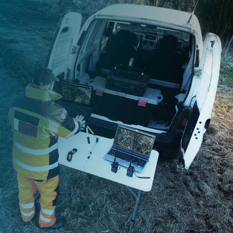
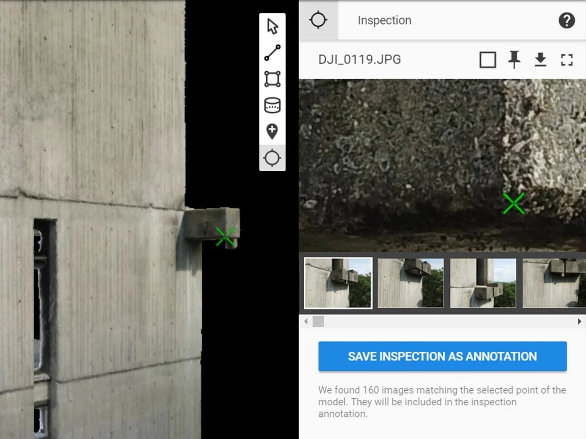
PIX4Dcloud is an online photogrammetry platform that processes aerial and terrestrial imagery into measurable 2D maps and 3D models directly in the cloud. It is used by construction managers, surveyors, engineers, and infrastructure teams to document sites, track progress, and generate survey-grade outputs without local processing software.
Using PIX4D processing algorithms, the platform transforms .jpg and .tiff imagery into orthomosaics, DSMs, point clouds, and textured meshes. Teams can measure distances, areas, and volumes, compare changes over time, and collaborate through a browser-based interface from virtually any location.
Core Features And Operational Advantages
- Survey-Grade Processing: PIX4D algorithms generate accurate geospatial outputs.
- AutoGCPs Integration: Improve accuracy using automated ground control enhancement.
- Multi-Camera Support: Process mixed datasets within a single project.
- 2D Orthomosaics: Export GeoTiff mapping outputs for GIS workflows.
- Surface Models: Generate DSM and DEM elevation datasets.
- 3D Point Clouds: Deliver .las files for engineering applications.
- Textured Mesh Exports: Produce .fbx and .obj 3D models.
- Measurement Tools: Calculate distances, areas, and volumes precisely.
- Timeline Comparison: Track changes between image maps over time.
- Design Overlay: Compare as-built and as-designed conditions visually.
PIX4Dcloud centralizes mapping, measurement, and documentation in a secure online environment. It standardizes deliverables using industry formats while enabling collaboration between field crews, engineers, and stakeholders. From construction verification to volumetric analysis, it provides consistent, measurable outputs that integrate directly into professional workflows.
At DSLRPros, we support complete UAV lifecycle solutions, from aircraft deployment to data processing strategy. Purchasing PIX4Dcloud through DSLRPros ensures your mapping operations are aligned with proven UAS workflows and long-term support. Contact DSLRPros to integrate PIX4Dcloud into your professional mapping environment.
PIX4Dcloud: Cloud-Based Drone Mapping and Site Documentation Platform
PIX4Dcloud is an online photogrammetry platform that processes aerial and terrestrial imagery into measurable 2D maps and 3D models directly in the cloud. It is used by construction managers, surveyors, engineers, and infrastructure teams to document sites, track progress, and generate survey-grade outputs without local processing software.
Using PIX4D processing algorithms, the platform transforms .jpg and .tiff imagery into orthomosaics, DSMs, point clouds, and textured meshes. Teams can measure distances, areas, and volumes, compare changes over time, and collaborate through a browser-based interface from virtually any location.
Core Features And Operational Advantages
- Survey-Grade Processing: PIX4D algorithms generate accurate geospatial outputs.
- AutoGCPs Integration: Improve accuracy using automated ground control enhancement.
- Multi-Camera Support: Process mixed datasets within a single project.
- 2D Orthomosaics: Export GeoTiff mapping outputs for GIS workflows.
- Surface Models: Generate DSM and DEM elevation datasets.
- 3D Point Clouds: Deliver .las files for engineering applications.
- Textured Mesh Exports: Produce .fbx and .obj 3D models.
- Measurement Tools: Calculate distances, areas, and volumes precisely.
- Timeline Comparison: Track changes between image maps over time.
- Design Overlay: Compare as-built and as-designed conditions visually.
PIX4Dcloud centralizes mapping, measurement, and documentation in a secure online environment. It standardizes deliverables using industry formats while enabling collaboration between field crews, engineers, and stakeholders. From construction verification to volumetric analysis, it provides consistent, measurable outputs that integrate directly into professional workflows.
At DSLRPros, we support complete UAV lifecycle solutions, from aircraft deployment to data processing strategy. Purchasing PIX4Dcloud through DSLRPros ensures your mapping operations are aligned with proven UAS workflows and long-term support. Contact DSLRPros to integrate PIX4Dcloud into your professional mapping environment.
Original: $129.00
-70%$129.00
$38.70Description
PIX4Dcloud: Cloud-Based Drone Mapping and Site Documentation Platform
PIX4Dcloud is an online photogrammetry platform that processes aerial and terrestrial imagery into measurable 2D maps and 3D models directly in the cloud. It is used by construction managers, surveyors, engineers, and infrastructure teams to document sites, track progress, and generate survey-grade outputs without local processing software.
Using PIX4D processing algorithms, the platform transforms .jpg and .tiff imagery into orthomosaics, DSMs, point clouds, and textured meshes. Teams can measure distances, areas, and volumes, compare changes over time, and collaborate through a browser-based interface from virtually any location.
Core Features And Operational Advantages
- Survey-Grade Processing: PIX4D algorithms generate accurate geospatial outputs.
- AutoGCPs Integration: Improve accuracy using automated ground control enhancement.
- Multi-Camera Support: Process mixed datasets within a single project.
- 2D Orthomosaics: Export GeoTiff mapping outputs for GIS workflows.
- Surface Models: Generate DSM and DEM elevation datasets.
- 3D Point Clouds: Deliver .las files for engineering applications.
- Textured Mesh Exports: Produce .fbx and .obj 3D models.
- Measurement Tools: Calculate distances, areas, and volumes precisely.
- Timeline Comparison: Track changes between image maps over time.
- Design Overlay: Compare as-built and as-designed conditions visually.
PIX4Dcloud centralizes mapping, measurement, and documentation in a secure online environment. It standardizes deliverables using industry formats while enabling collaboration between field crews, engineers, and stakeholders. From construction verification to volumetric analysis, it provides consistent, measurable outputs that integrate directly into professional workflows.
At DSLRPros, we support complete UAV lifecycle solutions, from aircraft deployment to data processing strategy. Purchasing PIX4Dcloud through DSLRPros ensures your mapping operations are aligned with proven UAS workflows and long-term support. Contact DSLRPros to integrate PIX4Dcloud into your professional mapping environment.