PIX4Dsurvey
PIX4Dsurvey: Bridge Photogrammetry And CAD With Precision Vectorization
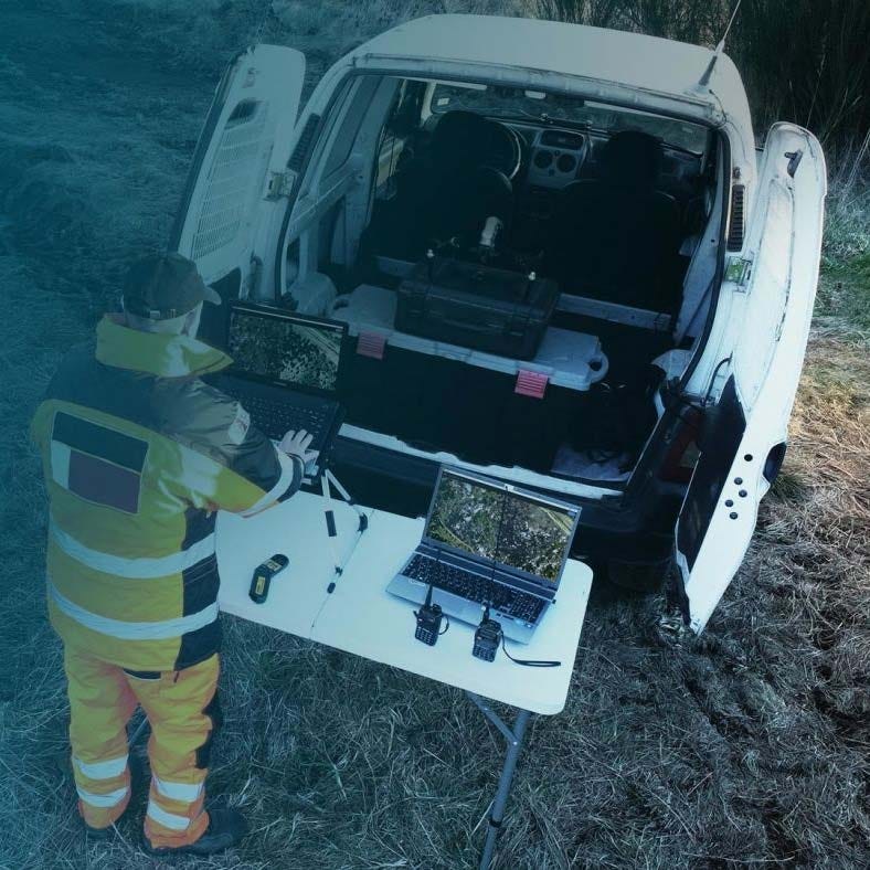
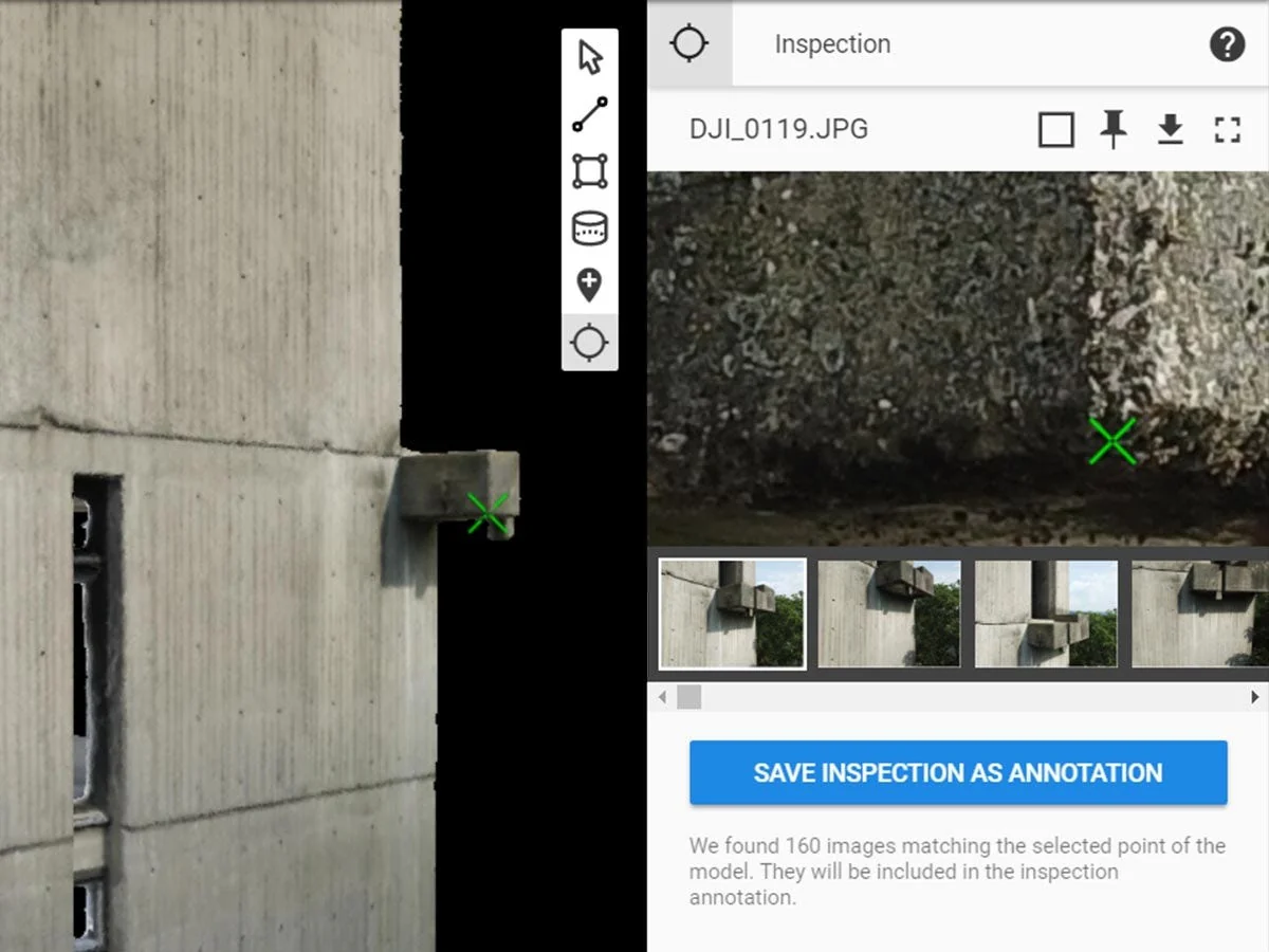
PIX4Dsurvey is a desktop software designed to bridge photogrammetry and CAD by transforming dense point clouds into survey-ready vector data. It enables users to access original images and 3D point clouds to extract points, polylines, polygons, and catenaries efficiently. Built for handling very large datasets, PIX4Dsurvey supports seamless import of PIX4Dmapper and PIX4Dmatic projects as well as third-party LAS and LAZ point clouds. It accelerates the transition from image-based reconstruction to structured CAD or GIS deliverables.
Core Features And CAD Integration Capabilities
- Vector extraction tools: create points, polylines, polygons, and catenaries.
- Large dataset support: handle billions of point cloud records.
- Terrain classification workflow: separate terrain and non-terrain classes.
- Grid of points automation: generate smart spot elevations.
- TIN surface creation: build DTMs from classified terrain points.
- LandXML export capability: deliver surfaces compatible with CAD.
- DXF and SHP export: transfer vector data to CAD or GIS.
- Third-party point cloud import: accept LAS and LAZ formats.
- Project registration tool: align multiple point clouds accurately.
- Desktop processing environment: operate locally on Windows or macOS.
PIX4Dsurvey does not replace photogrammetry processing software but completes the workflow after dense point cloud generation. By focusing on vectorization and terrain modeling, it shortens delivery timelines for survey and engineering projects. It provides structured outputs compatible with established CAD and GIS environments.
When you purchase PIX4Dsurvey from DSLRPros, you obtain an authorized license backed by a UAS solutions provider experienced in end-to-end drone data workflows. We help ensure proper alignment between your photogrammetry tools and CAD deliverables. Order PIX4Dsurvey from DSLRPros to streamline your survey data production.
PIX4Dsurvey: Bridge Photogrammetry And CAD With Precision Vectorization
PIX4Dsurvey is a desktop software designed to bridge photogrammetry and CAD by transforming dense point clouds into survey-ready vector data. It enables users to access original images and 3D point clouds to extract points, polylines, polygons, and catenaries efficiently. Built for handling very large datasets, PIX4Dsurvey supports seamless import of PIX4Dmapper and PIX4Dmatic projects as well as third-party LAS and LAZ point clouds. It accelerates the transition from image-based reconstruction to structured CAD or GIS deliverables.
Core Features And CAD Integration Capabilities
- Vector extraction tools: create points, polylines, polygons, and catenaries.
- Large dataset support: handle billions of point cloud records.
- Terrain classification workflow: separate terrain and non-terrain classes.
- Grid of points automation: generate smart spot elevations.
- TIN surface creation: build DTMs from classified terrain points.
- LandXML export capability: deliver surfaces compatible with CAD.
- DXF and SHP export: transfer vector data to CAD or GIS.
- Third-party point cloud import: accept LAS and LAZ formats.
- Project registration tool: align multiple point clouds accurately.
- Desktop processing environment: operate locally on Windows or macOS.
PIX4Dsurvey does not replace photogrammetry processing software but completes the workflow after dense point cloud generation. By focusing on vectorization and terrain modeling, it shortens delivery timelines for survey and engineering projects. It provides structured outputs compatible with established CAD and GIS environments.
When you purchase PIX4Dsurvey from DSLRPros, you obtain an authorized license backed by a UAS solutions provider experienced in end-to-end drone data workflows. We help ensure proper alignment between your photogrammetry tools and CAD deliverables. Order PIX4Dsurvey from DSLRPros to streamline your survey data production.
Original: $150.00
-70%$150.00
$45.00Description
PIX4Dsurvey: Bridge Photogrammetry And CAD With Precision Vectorization
PIX4Dsurvey is a desktop software designed to bridge photogrammetry and CAD by transforming dense point clouds into survey-ready vector data. It enables users to access original images and 3D point clouds to extract points, polylines, polygons, and catenaries efficiently. Built for handling very large datasets, PIX4Dsurvey supports seamless import of PIX4Dmapper and PIX4Dmatic projects as well as third-party LAS and LAZ point clouds. It accelerates the transition from image-based reconstruction to structured CAD or GIS deliverables.
Core Features And CAD Integration Capabilities
- Vector extraction tools: create points, polylines, polygons, and catenaries.
- Large dataset support: handle billions of point cloud records.
- Terrain classification workflow: separate terrain and non-terrain classes.
- Grid of points automation: generate smart spot elevations.
- TIN surface creation: build DTMs from classified terrain points.
- LandXML export capability: deliver surfaces compatible with CAD.
- DXF and SHP export: transfer vector data to CAD or GIS.
- Third-party point cloud import: accept LAS and LAZ formats.
- Project registration tool: align multiple point clouds accurately.
- Desktop processing environment: operate locally on Windows or macOS.
PIX4Dsurvey does not replace photogrammetry processing software but completes the workflow after dense point cloud generation. By focusing on vectorization and terrain modeling, it shortens delivery timelines for survey and engineering projects. It provides structured outputs compatible with established CAD and GIS environments.
When you purchase PIX4Dsurvey from DSLRPros, you obtain an authorized license backed by a UAS solutions provider experienced in end-to-end drone data workflows. We help ensure proper alignment between your photogrammetry tools and CAD deliverables. Order PIX4Dsurvey from DSLRPros to streamline your survey data production.