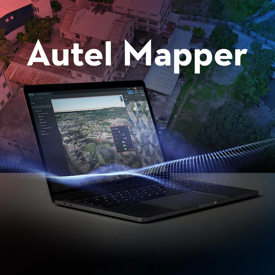
Autel Mapper
Autel Mapper: Professional Drone Photogrammetry Processing Software
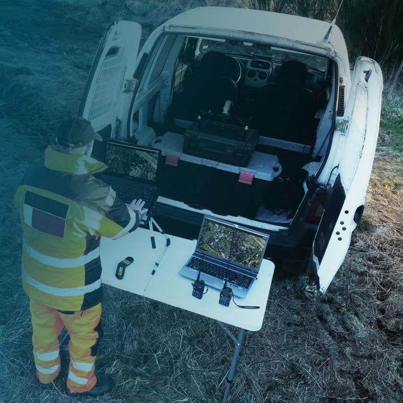
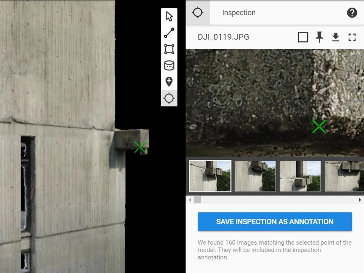
Autel Mapper is a desktop photogrammetry software platform designed to convert drone imagery into accurate 2D maps and 3D models for surveying, inspection, and mapping workflows.
It processes aerial imagery to generate orthomosaics, digital surface models, point clouds, and textured 3D models suitable for GIS, CAD, and geospatial analysis. The software supports aerial triangulation, reconstruction pipelines, and ground control workflows to improve positional accuracy.
Autel Mapper integrates closely with Autel enterprise drones and enables professionals in surveying, construction, public safety, and infrastructure inspection to convert captured imagery into reliable mapping deliverables.
Autel Mapper Core Features And Photogrammetry Workflow Capabilities
- Photogrammetry processing engine: convert drone imagery into precise geospatial mapping products.
- Aerial triangulation workflow: calculate camera position and orientation for reconstruction accuracy.
- 2D reconstruction outputs: generate orthomosaic maps and digital surface models.
- 3D reconstruction engine: produce dense point clouds and textured mesh models.
- Ground control support: import and optimize GCPs to improve positional accuracy.
- Coordinate system flexibility: configure WGS84 UTM and custom coordinate systems.
- Task queue processing: manage multiple reconstruction jobs within one workflow environment.
- Image metadata support: process JPEG imagery with embedded POS positioning information.
- Large dataset workflows: process aerial mapping datasets from enterprise drone missions.
- Multi-format exports: generate deliverables compatible with GIS and CAD platforms.

Autel Mapper provides a complete photogrammetry reconstruction pipeline for converting aerial imagery into mapping products used across surveying, inspection, and infrastructure documentation.
The platform supports efficient dataset processing, flexible coordinate systems, and standardized output formats for integration with professional geospatial software. These capabilities allow mapping teams to transform drone imagery into usable terrain models, orthomosaics, and 3D representations for operational analysis.
When you purchase Autel Mapper from DSLRPros, you receive professional software licensing from a UAV solutions provider experienced in enterprise drone mapping workflows. DSLRPros supports customers working in surveying, infrastructure inspection, construction documentation, and public safety mapping.
Purchase Autel Mapper from DSLRPros to integrate photogrammetry processing into your enterprise drone operations.
Autel Mapper: Professional Drone Photogrammetry Processing Software
Autel Mapper is a desktop photogrammetry software platform designed to convert drone imagery into accurate 2D maps and 3D models for surveying, inspection, and mapping workflows.
It processes aerial imagery to generate orthomosaics, digital surface models, point clouds, and textured 3D models suitable for GIS, CAD, and geospatial analysis. The software supports aerial triangulation, reconstruction pipelines, and ground control workflows to improve positional accuracy.
Autel Mapper integrates closely with Autel enterprise drones and enables professionals in surveying, construction, public safety, and infrastructure inspection to convert captured imagery into reliable mapping deliverables.
Autel Mapper Core Features And Photogrammetry Workflow Capabilities
- Photogrammetry processing engine: convert drone imagery into precise geospatial mapping products.
- Aerial triangulation workflow: calculate camera position and orientation for reconstruction accuracy.
- 2D reconstruction outputs: generate orthomosaic maps and digital surface models.
- 3D reconstruction engine: produce dense point clouds and textured mesh models.
- Ground control support: import and optimize GCPs to improve positional accuracy.
- Coordinate system flexibility: configure WGS84 UTM and custom coordinate systems.
- Task queue processing: manage multiple reconstruction jobs within one workflow environment.
- Image metadata support: process JPEG imagery with embedded POS positioning information.
- Large dataset workflows: process aerial mapping datasets from enterprise drone missions.
- Multi-format exports: generate deliverables compatible with GIS and CAD platforms.
Autel Mapper provides a complete photogrammetry reconstruction pipeline for converting aerial imagery into mapping products used across surveying, inspection, and infrastructure documentation.
The platform supports efficient dataset processing, flexible coordinate systems, and standardized output formats for integration with professional geospatial software. These capabilities allow mapping teams to transform drone imagery into usable terrain models, orthomosaics, and 3D representations for operational analysis.
When you purchase Autel Mapper from DSLRPros, you receive professional software licensing from a UAV solutions provider experienced in enterprise drone mapping workflows. DSLRPros supports customers working in surveying, infrastructure inspection, construction documentation, and public safety mapping.
Purchase Autel Mapper from DSLRPros to integrate photogrammetry processing into your enterprise drone operations.
Original: $149.00
-70%$149.00
$44.70Description
Autel Mapper: Professional Drone Photogrammetry Processing Software
Autel Mapper is a desktop photogrammetry software platform designed to convert drone imagery into accurate 2D maps and 3D models for surveying, inspection, and mapping workflows.
It processes aerial imagery to generate orthomosaics, digital surface models, point clouds, and textured 3D models suitable for GIS, CAD, and geospatial analysis. The software supports aerial triangulation, reconstruction pipelines, and ground control workflows to improve positional accuracy.
Autel Mapper integrates closely with Autel enterprise drones and enables professionals in surveying, construction, public safety, and infrastructure inspection to convert captured imagery into reliable mapping deliverables.
Autel Mapper Core Features And Photogrammetry Workflow Capabilities
- Photogrammetry processing engine: convert drone imagery into precise geospatial mapping products.
- Aerial triangulation workflow: calculate camera position and orientation for reconstruction accuracy.
- 2D reconstruction outputs: generate orthomosaic maps and digital surface models.
- 3D reconstruction engine: produce dense point clouds and textured mesh models.
- Ground control support: import and optimize GCPs to improve positional accuracy.
- Coordinate system flexibility: configure WGS84 UTM and custom coordinate systems.
- Task queue processing: manage multiple reconstruction jobs within one workflow environment.
- Image metadata support: process JPEG imagery with embedded POS positioning information.
- Large dataset workflows: process aerial mapping datasets from enterprise drone missions.
- Multi-format exports: generate deliverables compatible with GIS and CAD platforms.
Autel Mapper provides a complete photogrammetry reconstruction pipeline for converting aerial imagery into mapping products used across surveying, inspection, and infrastructure documentation.
The platform supports efficient dataset processing, flexible coordinate systems, and standardized output formats for integration with professional geospatial software. These capabilities allow mapping teams to transform drone imagery into usable terrain models, orthomosaics, and 3D representations for operational analysis.
When you purchase Autel Mapper from DSLRPros, you receive professional software licensing from a UAV solutions provider experienced in enterprise drone mapping workflows. DSLRPros supports customers working in surveying, infrastructure inspection, construction documentation, and public safety mapping.
Purchase Autel Mapper from DSLRPros to integrate photogrammetry processing into your enterprise drone operations.